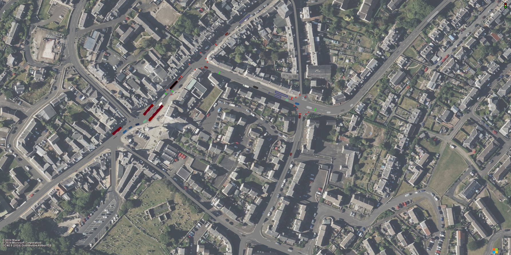
Trunk roads authorities have undertaken numerous detailed road and traffic surveys* to inform potential improvements for pedestrians and those using wheels (e.g. cyclists, wheelchair users) on the A7 Selkirk town centre since the public consultation concluded late last year.
Transport Scotland, BEAR Scotland and Scottish Borders Council (SBC) have met to review the results of the surveys and agree next steps.
As a result, specialist engineering contractor, Jacobs, has been tasked with building a base traffic model which initially looks at the introduction of pedestrian crossings at the High Street/Tower Street junction. This location was one of three priority sites highlighted in the public consultation. The other two were Market Place/Ettrick Terrace junction and the Tower Street footways.
This process will interrogate how traffic lights at this junction would impact traffic flow and pedestrian movements in the wider area.
As Scottish Borders Council has been considering the establishment of a one-way system on the local network along High Street and Tower Street, this is being considered in the initial development of options to be tested using the traffic model.
Tommy Deans, Network Manager at BEAR Scotland said:
“The various in-depth surveys undertaken over the last few months have offered a more in-depth analysis of the hot spot areas highlighted by locals. The surveys include detailed surveys on traffic flow data, pedestrian and traffic movement data and underground utility equipment mapping.
“It has been decided to focus on investigating the potential impact of improving one of the priority locations in the first instance. The model will look at how traffic lights at this junction would impact on traffic flow and pedestrian movements in the wider area. Once we understand that we can then take it from there and look at other options.
“We are hoping the model on the above can be completed and initial assessment of the options will start this side of Christmas.
“We appreciate the patience of the community while we identify potential improvement options. These things take time but it’s important that everything is considered appropriately.”
For updates on this project, please subscribe to the Walk A7 Selkirk project page Have Your Say Today – Walk A7 Selkirk – Commonplace.
*Traffic surveys undertaken:
|
|
|
|
|
|
|
|
|
Image: Traffic modelled network overlaid on a satellite image. Vehicles can be seen using the dark grey road network. Other elements such as traffic lights and pedestrian crossings (denoted by the red and green lines) and bus laybys (the crimson rectangles) can also be seen.